Big Data Analysis for Water-related Applications
This online course introduces the participants to Earth Engine Code Editor platform, explore some basic programming concepts, Earth Engine data structures and methods, functions, and algorithms, and implementation of surface water detection algorithm.
Course Start
Dec 21, 2020
Course End
Dec 10, 2026
Duration
18:00 hours
Certificate
Yes
About this Course
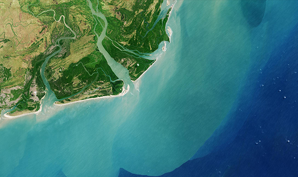
Google Earth Engine (GEE) is a cloud-based geospatial remote sensing processing platform, complete with an extensive public data catalogue. It is available via a web-based JavaScript Application Program Interface (API) called the Code Editor. This platform is where users can write and execute scripts to share and repeat geospatial analysis and processing workflows, such as surface water detection, land cover mapping, biomass estimation, etc.
This online course introduces the participants to Earth Engine Code Editor platform, explore some basic programming concepts, Earth Engine data structures and methods, functions, and algorithms, and implementation of surface water detection algorithm including:
- Normalized Difference Water Index (NDWI)
- Normalized Difference Moisture Index (NDMI)
- Modified Normalized Difference Water Index (MNDWI)
- Normalized Difference Pond Index (NDPI)
- Water Ratio Index (WRI)
- Simple Water Index (SWI)
The course will be structured with presentations and demonstrations to introduce material, followed by assessments that participants complete individually.
What you will learn
After completing the course, the participants will be able to:
- Understand the GEE Code Editor platform
- Analyze big data on cloud platform using geospatial Earth Engine Objects and their associated functions (images and image collections, features and feature collections, and geometries).
- Develop an understanding of various methods to detect surface water at the national, regional and global scale.
Specific knowledge and skills gained:
- Knowledge of key JavaScript concepts and Earth Engine syntax.
- Ability to access Earth observation data from various public data catalogs on a cloud platform.
- Implement various surface water detection methods in Earth Engine at the national, regional and global scale.
Target Audience
Water professionals and postgraduate students with interests in using big data and cloud computing to map surface water.
Course developed by
Hamid Mehmood
Senior Researcher: Hydro-informatics and Information Technology
United Nations University Institute for Water, Environment and Health
Sami Kurani
Spatial Analyst
UNU-INWEH MUST Scholar